On Wednesday, Marion County Public Schools announced there will be no school Thursday.
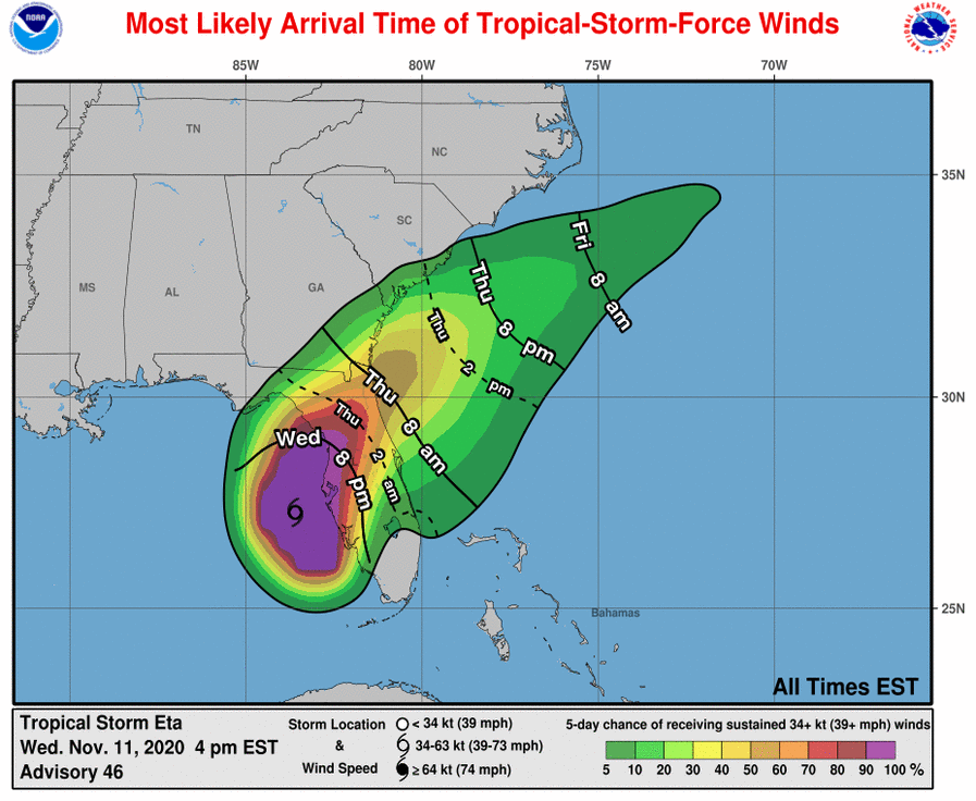
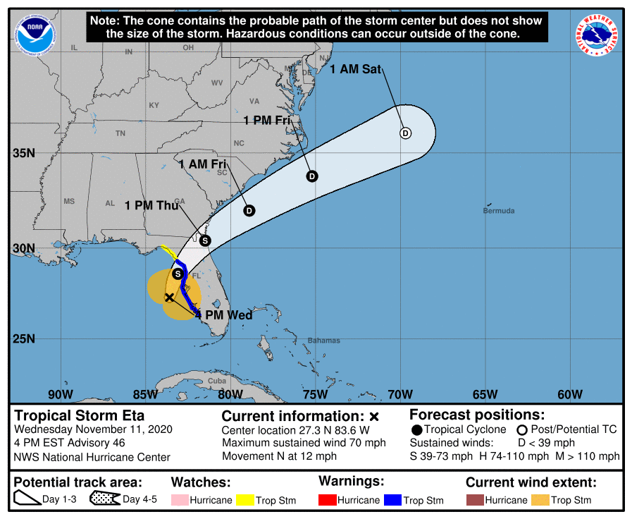
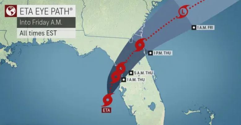
The National Weather Service in Jacksonville issued a severe weather statement in anticipation of Storm ETA making landfall.
A Tropical Storm warning remains in effect for Central Marion, Eastern Alachua, Eastern Marion, Gilchrist, Western Alachua, Western Marion, and Citrus County.
A Flood Watch is in effect for:
Sumter, Pinellas, Polk, Hardee, Highlands, DeSoto-Coastal, Levy-Coastal, Citrus-Coastal, Hernando-Coastal, Pasco-Coastal, Hillsborough-Coastal, Manatee-Coastal, Sarasota-Coastal Charlotte-Coastal, Lee, Levy-Inland, Citrus-Inland, Hernando-Inland, Pasco-Inland Hillsborough-Inland, Manatee-Inland, Sarasota-Inland, and Charlotte-Inland.
The Flood Watch also extends to the following areas:
Lake Panasoffkee, Venice, Port Charlotte, Lakewood Ranch, Yankeetown, Bushnell, Hudson, St. Petersburg, Brandon, Port Richey, Dade City, Clearwater, Zolfo Springs, Hernando, Beach, Myakka City, Fort Myers, Plant City, Placid Lakes, The Villages, Crystal River, Anna Maria Island, Brooksville, Sarasota, Avon Park, Cape Coral, Babcock Ranch, Apollo Beach, Cedar Key, Parrish, Zephyrhills, Homosassa, Tampa, Wauchula, Arcadia, Englewood, Bradenton, Sanibel, Spring Hill, Lakeland, Chiefland, Sebring, Bayport, Largo, Wildwood, Winter Haven, Westchase, Sun City Center, North Port, Punta Gorda, Bowling Green, Bronson, Inverness, Captiva, Williston, and Lehigh Acres.
Equivalent Tropical Storm force wind – Peak Wind Forecast: 35-45 mph with gusts to 55 mph with a window for Tropical Storm force winds until Thursday afternoon. The storm has a Potential for wind from 58 to 73 mph and is favorable for tornadoes.
Localized rainfall flooding may occur.
Rivers and tributaries may quickly rise with swifter currents. Small streams, creeks, canals, and ditches may become swollen and overflow in spots. Floodwaters could enter structures, especially in usually vulnerable spots — places where rapid ponding of water occurs at underpasses, low-lying spots, and poor drainage areas. Storm drains and retention ponds
could become and begin to overflow.
There is a potential for a few tornadoes and the threat remains in place.
Residents should secure all loose objects outside of their homes.
Road closures and power outages are possible.