[Last updated on April 23, 2020, at 10:55 p.m.]
The National Weather Service has issued a severe thunderstorm warning for northeast Florida, with a chance to reach Central Florida.
Article continued below
For Marion County–showers and thunderstorms before 2 a.m, then showers likely and possibly a thunderstorm between 2 a.m and 3 a.m, then showers and thunderstorms likely after 3 a.m. Some storms could be severe, with large hail, damaging winds, and heavy rain.
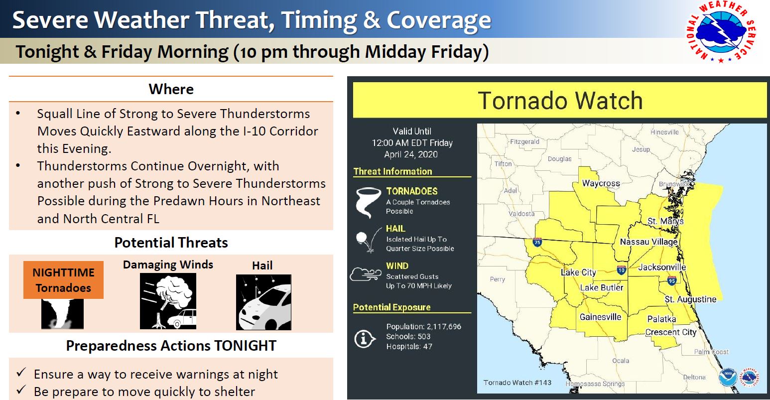
The NWS said these storms have the potential to produce nighttime tornadoes.
Article continued below
Enhanced Risk of Severe Thunderstorms Thursday into Friday Morning
• When: Thursday afternoon through Late Friday
• Where: Southeast GA and Northeast Florida
• What: Tornadoes, Damaging Wind Gusts, Hail, & Heavy Rain Possible
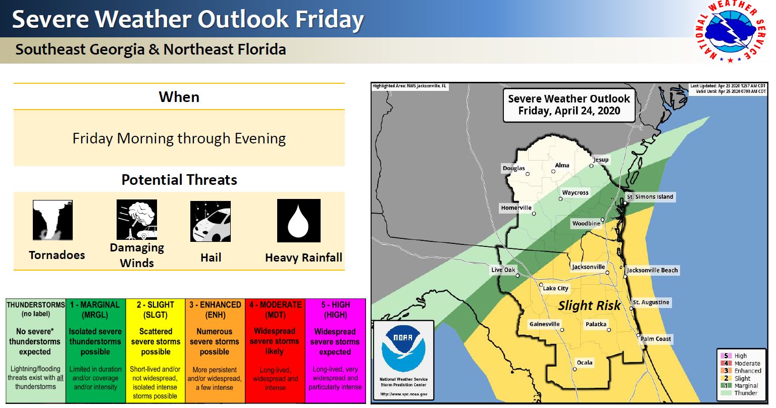
Slight Risk of Severe Thunderstorms Friday
• When: Friday Morning Through Friday Afternoon/Evening
• Where: Northeast Florida and parts of Southeast Georgia
• What: Tornadoes, Damaging Wind Gusts, Hail, & Heavy Rain Possible
Severe Thunderstorm Potential possible again Saturday
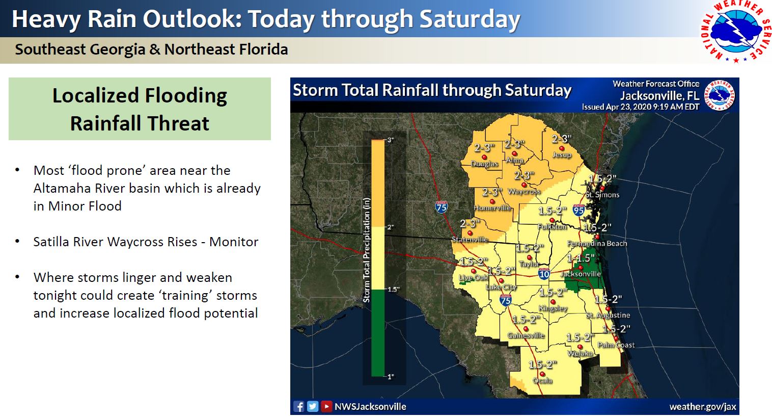
Minor Flooding Forecast along Altamaha River Basin
Secure anything that could potentially become projectile.