
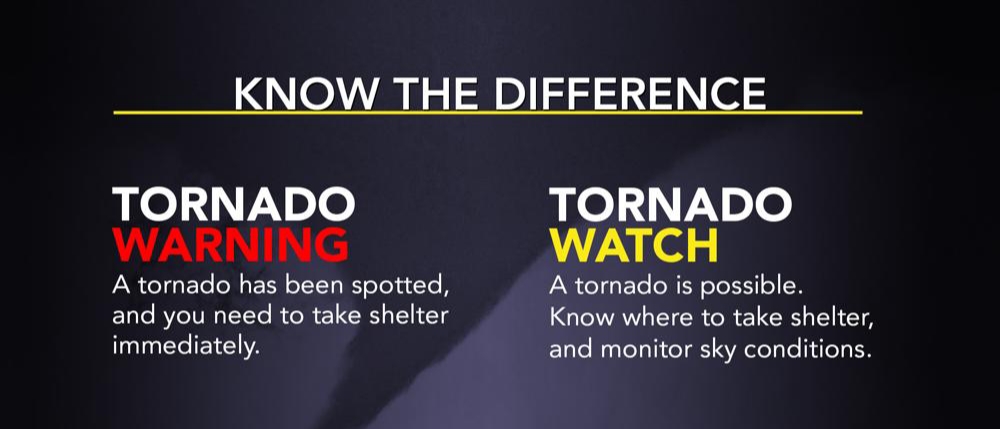
TORNADO WATCH 32 REMAINS VALID UNTIL MIDNIGHT TONIGHT FOR THE FOLLOWING AREAS IN FLORIDA.
THIS WATCH INCLUDES 11 COUNTIES IN NORTHEAST FLORIDA.
CLAY, DUVAL, FLAGLER, NASSAU, PUTNAM, ST. JOHNS IN NORTHERN FLORIDA, ALACHUA, BRADFORD, GILCHRIST, MARION, UNION IN GEORGIA.
THIS WATCH INCLUDES 2 COUNTIES IN SOUTHEAST GEORGIA CAMDEN GLYNN.
THIS INCLUDES THE CITIES OF AMELIA CITY, ANASTASIA, ANTHONY, ARLINGTON, BAKERSVILLE, BELLAIR, BOSTWICK, BURBANK, CARRAWAY, COUNTRY CLUB ESTATE, DOCK JUNCTION, DOCTORS INLET, DOVER BLUFF, DUNGENESS, DURBIN, FERNANDINA BEACH, FRUIT COVE, GAINESVILLE, GAINESVILLE AIRPORT, GLYNN HAVEN, HILLIARD, JACKSONVILLE, JEKYLL ISLAND, KINGS FERRY, KINGSLAND, LAKE BUTLER, LAKESIDE, MIDDLEBURG, NEW RIVER, NEWNANS LAKE, NORMANDY, OCALA, OCALA AIRPORT, OCEANWAY, ORANGE PARK, ORTEGA, PALATKA, PALM COAST, PALM VALLEY, PONTE VEDRA BEACH, RATLIFF, RIVERSIDE, SAN MARCO, SEA ISLAND, ST. SIMONS, STARKE, SWITZERLAND, THALMANN, TRENTON, WEIRSDALE, AND YULEE.
Wind Advisory
Hamilton-Suwannee-Baker-Inland Nassau-Inland Duval-Union-Bradford- Clay-Inland St. Johns-Gilchrist-Putnam-Inland Flagler- Northern Columbia-Coastal Nassau-Coastal Duval-Coastal St. Johns- Eastern Alachua-Coastal Flagler-Eastern Marion-Southern Columbia- Western Alachua-Central Marion-Western Marion-Coffee-Jeff Davis- Bacon-Appling-Wayne-Atkinson-Pierce-Brantley-Inland Glynn- Coastal Glynn-Echols-Clinch-Inland Camden-Coastal Camden- Northern Ware-Northeastern Charlton-Southern Ware- Western Charlton- Including the cities of Jasper, Jennings, West Lake, Belmont, White Springs, Houston, Live Oak, McAlpin, Newburn, Suwannee Springs, Macclenny, Olustee, Ratliff, Hilliard, Kings Ferry, Bryceville, Normandy, Ortega, Riverside, San Marco, Lake Butler, Starke, New River, Doctors Inlet, Lakeside, Bellair, Middleburg, Orange Park, Fruit Cove, Switzerland, Bakersville, Picolata, Trenton, Bostwick, Carraway, Palatka, Bunnell, Espanola, Andalusia, Winfield, Suwannee Valley, Amelia City, Fernandina Beach, Yulee, Arlington, Jacksonville, Oceanway, Tallyrand, Ponte Vedra Beach, Durbin, Palm Valley, Anastasia, Saint Augustine, Gainesville, Gainesville Airport, Newnans Lake, Palm Coast, Lynne, Moss Bluff, Columbia, Lake City, Oleno State Park, Lulu, Watertown, High Springs, Newberry, Archer, Anthony, Burbank, Ocala, Weirsdale, Ocala Airport, Douglas, Hazlehurst, Alma, New Lacy, Baxley, Pine Grove, Plant Hatch, Doctortown, Gardi, Jesup, Axson, Pearson, Willacoochee, Blackshear, Atkinson, Hickox, Hortense, Nahunta, Raybon, Waynesville, Hoboken, Thalmann, Jekyll Island, Glynn Haven, Sea Island, St. Simons, Country Club Estate, Dock Junction, Needmore, Statenville, Homerville, Colesburg, Tarboro, Waverly, Woodbine, Dover Bluff, Kingsland, Dungeness, Needham, Waycross, Winokur, Folkston, St. George, Homeland, Race Pond, and Stephen Foster State Park 209 AM EST
Thu Feb 6 2020 …WIND ADVISORY IN EFFECT FROM NOON TODAY TO 3 AM EST FRIDAY… Southwest winds 15 to 25 mph with gusts up to 40 mph expected. Portions of southeast Georgia and northeast and northern Florida. From noon today to 3 AM EST Friday. Gusty winds could blow around unsecured objects. Tree limbs could be blown down and a few power outages may result.
PRECAUTIONARY/PREPAREDNESS ACTIONS… Use extra caution when driving, especially if operating a high profile vehicle. Secure outdoor object